

Climbing to alpine lakes and wildflower meadows atop the highest mountains in Montana, the Beartooth Highway is a spectacular route to Yellowstone National Park.
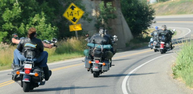
This spring, American Motorcyclist Association selected the highway as their favorite stretch of road in the United States, topping almost 100 other roadways. And, in June, a variety of activities are planned in nearby communities to mark the 75th anniversary of the opening of the roadway.
The Beartooth Highway also is a link in a loop drive through other Montana and Wyoming wildlands steeped in history and beauty. This outside-the-park Beartooth loop can take you from Cody, Wyo.; Cooke City; or Red Lodge over mountains, through Sunlight Basin and along Beartooth foothills.
The loop is formed by the Beartooth Highway, the Chief Joseph Highway, Wyoming Highway 120 and Route 308 between Belfry and Red Lodge.
People are also reading…
The Chief Joseph Scenic Highway meets the Beartooth Scenic Byway about 14 miles southeast of Cooke City. The Chief Joseph Highway cuts through the Clarks Fork River Canyon before intersecting Highway 120 just 17 miles north of Cody.
Highway history
The Chief Joseph Highway was named for the leader of a band of Nez Perce Indians that eluded the U.S. Army on a 1,500-mile trek from Oregon through Yellowstone Park and Montana to the Canada border in 1877. The Army had been sent after the Nez Perce to force them onto a reservation.
In the first week of September 1877, two U.S. Cavalry detachments — one commanded by Gen. Oliver Howard, the other by Col. Samuel Sturgis — surrounded the Nez Perce as they traveled through this rugged country east of Yellowstone Park.
But the Cavalry commanders didn't know exactly where the Nez Perce were. Sturgis moved his troops away from the Clarks Fork after concluding that there couldn't be a trail through the steep canyon. He was wrong.
Chief Joseph led his people, including children, sick and elderly, through the canyon. After escaping the Army near Dead Indian Hill (elevation 8,048 feet) near the route of the Chief Joseph Highway, the Nez Perce headed north into Montana.
Prospectors, miners and freight drivers used a rough road through the Clarks Fork Valley as early as 1884 to get from the mining camp at Cooke City to the town of Cody. The 51 miles of road that now traverses the area took 20 years to pave because of rugged mountains and winter weather.
It follows the Wild and Scenic Clarks Fork River, which carves a 20.5 miles course of waterfalls, cascades and narrow canyons. Chief Joseph Highway runs past U.S. Forest Service campgrounds, public and private lands and some summer homes.
It goes through the Swamp Lake wildlife habitat, where waterfowl and moose may be seen feeding. The wetland also is home to more than two dozen rare, mostly tundra plants.
Sunlight Basin
The highway runs through Sunlight Basin, so named by beaver trappers in the 1840s because it was so remote that sunlight was the only thing that could get into it in the wintertime.
Travelers can enjoy a view from the bridge 300 feet over Sunlight Creek. Beyond the bridge, the road climbs a hill and then starts a series of switchbacks to the summit of Dead Indian Hill. The view takes in the Absaroka and Beartooth mountain ranges as well as the Big Horn Basin of Wyoming.
If travelers head north on Wyoming Highway 120 from the Chief Joseph Highway, they will soon reach the town of Belfry. Turn toward the Beartooth Mountains again by going west from Belfry on Route 308, a paved two-lane road.
It will take you through rolling hills with expansive views of mountains and range land.
The tiny community of Bearcreek's greatest fame is a great tragedy. The town was the site of the Smith Mine disaster of Feb. 27, 1943. A small monument near Bearcreek recalls the 74 coal miners who lost their lives that day in one of the worst mine accidents up to that time.
Route 308 ends at Red Lodge, where the Beartooth Highway begins its westward climb. Built in the Great Depression as a federal WPA project, the highway offered employment to many men who otherwise would have been out of work.
The mountain route to Yellowstone had long been a dream of some Red Lodge boosters who foresaw that tourism could replace the loss of mining jobs after local coal mines had closed.
A 5-year project
The 67-mile highway from Red Lodge through Cooke City to Yellowstone's Northeast Entrance was constructed in five years, opening in 1936.
It zigzags up to Beartooth Pass (elevation 10,947 feet), presenting breathtaking views of the adjoining Beartooth Wilderness.
The Beartooth Highway is scheduled to open by Memorial Day in May, but late snows can postpone it. The road usually is open until September or October, depending on weather.
Once plowed, sections of the highway are like tunnels open on top, but with walls of snow several feet high on either side.
A trip on the Beartooth Highway in the first weeks of the season is an adventure in snow country for travelers who bring warm clothing and are prepared for winter driving conditions. Look for hardy, expert cross-country and downhill skiers along the way.
The snow will recede as the summer goes on, but visitors usually can make snowballs from roadside snow banks throughout the season.
Depending on the weather, the Beartooth wildflower show will peak in mid- to late July or early August. Even above timberline, travelers will see a rainbow carpet of low-growing flowers that survive the harsh climate and short growing season in fragile soils.